Friday 21 August 2015

Slalok Mountain via Joffre Lakes Attempt

On Tuesday I camped at Upper Joffre Lake with a group of friends. At 5am Wednesday morning I woke up with two others from the group and we attempted to summit Slalok Mountain. We did not reach the top as it required more difficult scrambling than we were prepared for.


We headed up the Taylor-Tszil Col as the sun came up.


Then around Tszil Mountain
East side of  Tszil Mountain

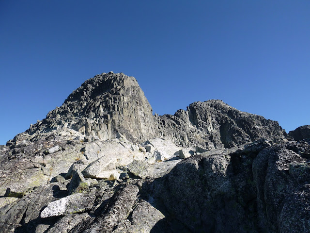
Slalok Mountain was the goal for the day. We only made it as far as the sub-summit. The scrambling was more difficult than we had bargained for.
West side of Slalok Mountain

Here's another photo of Slalok Mountain showing the sub-summit on the left.


The views of Upper Joffre Lake were nice on the way down.


A few notes:
-The trailhead is hidden. I spent Tuesday night looking for it to no avail. Wednesday morning I chose to go up a boulder field that looked like the best option, luckily the trail is next to this boulder field. My GPS marked this point as N 50°20.666' W 122°28.821'
-Joffre Lakes Trail is extremely busy, even on a weekday!
-I will return next year to try for Slalok Mountain again.

Friday 14 August 2015

Mt Webb and MacDonald Peak via Radium Lake

On Wednesday afternoon I drove 2 hours to Chilliwack Lake, then I hiked to Radium Lake where I camped for one night. In the morning I hiked up Mount Webb and MacDonald Peak, then headed back to campsite to gather my gear and hike down to the car.


I bought a backcountry camping permit here and parked at Chilliwack Lake Day-Use parking with a copy of the permit in my windshield. Then I followed the Trans-Canada-Trail (TCT) until the intersection with Radium Lake Trail. The trail is in good shape with all river crossings intact, including this very bouncy suspension bridge.


Radium Lake was a nice place to camp for a night.


I woke up with at dawn and hiked a well-flagged trail up the col between Mt Webb and MacDonald Peak. Here's a view looking down from the top of the col with Mount Corriveau behind.


Then I scrambled up Macdonald Peak. There were some cairns showing the easiest route, which involved circling the mountain counter-clockwise and reaching the summit from the South 
Macdonald Peak


Then I hiked up Mount Webb. I scrambled up the South side,
Mount Webb


I'd recommend this trip. Lots of great views once you're out of the treeline. It's possible to do as a long day-trip, keep in mind that the park gate closes between 10pm-8am. Also a mountain bike would be helpful for the first portion of the trail. A map of the area is here.

Friday 7 August 2015

Mount Bishop via Vicar Lakes

Yesterday I hiked Mount Bishop. I parked at the North end of Lillooet Road and cycled to the trailhead on Spur 4 road on the East side of the Seymour River.  I locked my bike and hiked up past Vicar Lakes and onto Mount Bishop.


The trailhead is near 12.5 km on Spur 4 Road. It's marked by orange square markers. It is easy to miss.


Vicar Lakes were very serene.


Such a foggy day, not much of a view. Wet rock made the scramble a little tricky.


A few notes:
-The trail from Spur 4 Road to Vicar Lakes is in amazing condition with lots of flagging and ropes, which help a lot because it's quite steep. A big thank you to whoever maintains this trail!
-At Vicar Lakes it meets up with the Indian Arm Trail which apparently continues towards Mount Dickens and beyond.
-Total time was 9.5 hours.
-Next time I would park at Lynn Headwaters to avoid the 100 speedbumps on Lillooet Road.
-Find a map of the Lower Seymour Conservation Reserve here. It does not show the trailhead.