Showing posts with label Lake. Show all posts

Monday, 24 October 2016

D'Arcy to Lillooet via Anderson and Seton Lakes

In September Kat and I paddled from D'Arcy to Lillooet. We travelled across Anderson and Seton Lakes with a nice portage in the middle.

First we drove two cars to Lillooet and parked one at the end of Seton Lake

Kat taking in the view from Lillooet end of Seton Lake. Observing what we were about to paddle.


Then we drove the second car to D'Arcy. There is a nice dock in D'Arcy to launch from.
The docks in D'Arcy.

We enjoyed calm water as we started our journey. We generally stayed near the right (South) side of the lake. A few hours in, whitecapped waves came out of nowhere, so we pulled over and relaxed for 3 hours until they subsided.
The spot we pulled over is really nice, someone had set up a picnic table and there's a clearing for camping.

Once the weather calmed we continued towards Seton Portage, the town between the lakes. We unloaded on a dock and carried our gear up a road and through town. There was a gate on the road, it was easy to walk around the gate.
Kat packing up our gear. The portage wasn't too long. We were probably about 1 hour all together.

We did not see anywhere to set up the tent in Seton Portage, so we launched from a beach on Seton Lake and paddled until we found a nice spot to camp on the lakeside.
View from camp looking towards Seton Portage. I saw two otters here, couldn't get the camera out in time.

Seton Lake has a nice glacial blue color. There are some narrow portions of the lake with large cliffs rising on either side. Railroad tracks follow the North side of the lake, so we stayed closer to that side, in case we would need to pull out and wait out wind. We were lucky for conditions and only encountered some minor headwind.
A journey's end.

This was extremely enjoyable trip! A few notes:
-A few people warned me about wind before setting out on this trip. While this could be an issue (as we saw on Anderson Lake), there are good places to pull out all along both lakes.
-Lake water was pleasantly warm, surprisingly warm for September.
-There are signs of "civilization" all along the trip; power lines, railroad tracks, cabins along the shore.
-We saw one power boat on Anderson Lake and nobody else on the water.
-There are lots of nice places to set up camp along the South side of Anderson Lake, fewer spots along Seton Lake.
-The gate on the road from Anderson Lake to Seton Portage could be tricky to navigate around with a hardshell boat.
-Birkenhead Lake was a nice place to sleep the night before the journey so we could have an early start.
-There is a motel in Seton Portage, staying there would allow one to avoid carrying overnight gear. There is also a restaurant/pub.

Sunday, 23 October 2016

Mount Rohr

With some nice mid-September weather, Kat and I decided to do Mount Rohr. Directions were fairly straightforward following the Matt Gunn scrambles book.

We camped at the far end above Rohr Lake.
We enjoyed a nice sunrise from camp.

The route to the summit was nice and easy to navigate. Mostly on talus. Summit had good views all around especially toward Joffre and Matier across the highway.

Kat's happy to be at the top. Highway 99 below and Joffre and Matier in the distance.

Very nice trip! Rohr Lake on it's own would be a worthy destination.

Wednesday, 18 May 2016

Mount Price via Garibaldi Lake

Monday night Michal and I headed to the Garibaldi Lake Trail. We parked around 9pm and hiked up to the lake by headlamp. We camped at the lake and woke at 5:30am to head up Mount Price.

The trail to Garibaldi Lake is in awesome condition. I still have only hiked up it at night.

The snow was a little soft so we got our snowshoes on and started heading up to Mount Price.
A little tricky route-finding through the trees.

We aimed to hit Mount Price from the West. That's where the topo map had the most gradual incline. We found a good snowslope and headed up.
Black Tusk in the background. A nice layer of fog on Garibaldi Lake.

We made our way up a short scree slope to the summit.


And finally we made it to the top where we enjoyed killer views of Mount Garibaldi, Black Tusk, the Table, the Tantalus Range, etc.

View from the top, fog has lifted off Garibaldi Lake. Looking towards Sphinx Bay.

Find Michal's website here
You can read about the time I paddled Garibaldi Lake here.

Tuesday, 5 April 2016

Flora Peak Snowshoe Attempt

On Friday Mark and I drove out to Chilliwack Lake Provincial Park to snowshoe up Flora Peak.

We also made a detour to Lindeman Lake

We parked along the side of Chilliwack Lake Road and made our way up the Flora Lake Trail. Around 1200m we hit the snowline. Mark was excited to put on his snowshoes.

This aussie's first time on snowshoes!

The main face looked super avalanch-y so we headed up the West ridge. It is a lower angle and has lots of trees. We stayed right to avoid cornices.

This is a sub-summit. True summit is hidden in background.


We decided that conditions looked sketchy near the top, so we did not continue to true summit. We enjoyed some soft-slushy snow and a great view on the way down.
That's Mount Webb on the right. I went up there in a 2015 post!

When we got back to the trailhead, we still had lots of daylight so we made the quick hike over to Lindeman Lake.
Shoes off, socks off, ahhhh life is good.

A few notes:
-We encountered two other people and they were really friendly! Follow them on Instagram @Sparkles2222 and @InTheRiverValley. They told us they had seen an avalanche in the area so be careful!
-Very nice area and great views for little effort!
-Flora Peak would make a great ski.
-I recently started an Instagram. You can find it here.

Thursday, 25 February 2016

Alouette Lake Overnight

On Sunday Ivan, Michal and I rented a Modo car, drove to Golden Ears Provincial Park, and paddle Alouette Lake.


We parked at the boat launch. Ivan and Michal brought a canoe, I brought my Innova Safari.
Only a few Modo cars have roof racks

We made a short detour up Gold Creek.
We turned around where the creek becomes whitewater.

Some nice views as we passed through the narrows.
Is Ivan taking a nap here?

Someone had built a weird shelter out of tarps near the North East side of the lake. We camped next to it.
Weird tarp structure on the right, tarp covered bbq on the left. Good camping about 50 meters North.

In the morning the weather was sunny. We gather our gear and finished a circle around the lake and back to the car.


A few notes:
-Wind can be a big factor in this lake, especially in the afternoon.
-Nice views of Robie Reid and Golden Ears peaks.
-The camping on the east side of the lake was nice. There are other camping spots closer to boat launch near the narrows and also on the south side of the lake.

Tuesday, 20 October 2015

Tricouni Peak

Last Thursday George and I hiked Tricouni Peak near Squamish.


It took about 2 hours to find the trailhead. There's some new logging roads in this area that make directions confusing. The first 45min-1 hour of the trail was quite muddy. 
There go my new shoes!


After the marshy part the views really opened up!
Tricouni is the pointy peak in the distance


Three glacier blue lakes were highlights of the day!
Upper lake with Tricouni in background


Scramble near the top wasn't too difficult
What! Another blue lake on the other side!

Ah one more photo on the way down.

Well done George!

And.... one more from second lake


A few notes:
-Great day hike, highly recommended. The lakes would make nice camping.
-Trailhead is super tricky to find. A new logging road had covered up the entrance to the road that leads to the trailhead.

Thursday, 1 October 2015

Mamquam Lake via Elfin Lakes

On Monday I drove to Squamish and  hiked from Garibaldi Diamond Head parking lot to the new campsite at Rampart Ponds. Tuesday morning I hiked the final 1.5km to Mamquam Lake and then headed back with a quick visit to Opal Cone.

Map courtesy of BC parks


It's permitted to take a bike as far as Elfin Lakes. I chose not to because I was worried about where to lock it up. Of course this portion of the trail was quite busy.
Elfin Lakes pretty as always


The trail to Mamquam Lake is in great shape! Bridges over both river crossings and lots of nice scenery!


My Garibaldi Park map shows Pyramid Mountain as a "scramble" and not a "climb". I was hoping to summit this mountain. The closer I got the more difficult it appeared to be, 
Pyramid Mountain will have to wait until my next visit to the area

The new campground at Rampart Ponds was nice. In the morning I visited Mamquam Lake.
Mamquam Lake


On the way back I visited the old volcano known as Opal Cone.
A touch on snow in the centre of the cone.

I met a friendly Czech hiker named Michal. He joined me for the rest of the way back.


-All together an enjoyable trip. Travel time was about 5 hours to Rampart Ponds and about 6 hours return (with a stop at Opal Cone and a lunch at Elfin). It's a smooth trail with lots of elevation gain and loss.

-I'm VERY interested in getting up Pyramid Mountain. If you have any info on it please let me know!

-BC Parks Garibaldi Map is available here

Monday, 27 July 2015

Sentinel Bay Hut via Garibaldi Lake

Check out Matt's version of the trip here. Matt had paddled Garibaldi Lake a few weeks earlier and saw snow above Sentinel Bay. He brought up the idea of skiing in July, so what the heck we went for it! On Wednesday night we hiked the Garibaldi Lake Trail with a kayak, skis, and tons other gear. We kayaked across the lake towards Sentinel Bay where we explored the area until Friday.


Damn our packs were heavy as we hit the trail around 9:30pm.


We arrived at Garibaldi Lake around 12:30am, loaded up the kayak (well past it's 400 lb suggested maximum) and paddled out. Fog was rolling off the lake giving the water a very eerie feeling. I was actually quite freaked out, luckily Matt's good humor calmed me down.


We reached the shore of sentinel bay around 3am, unloaded the kayak and passed out shoreside for a couple of hours.


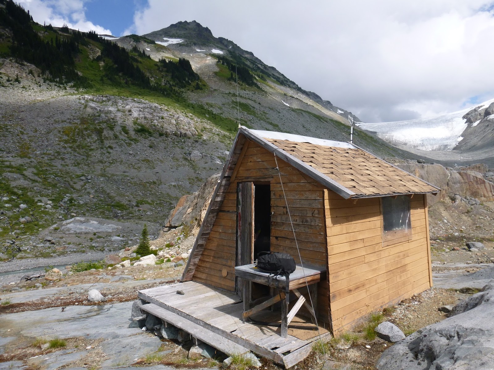
We made our way 1.5km to the glaciology hut that would be our home for the next two days.


We hauled our gear up from the shore.


Ah home sweet home


We rested a bit then made our way Southwest exploring the area.


Not quite enough snow for skiing unfortunately. 


We had some amazing views of the Table


Soon clouds took over the sky


It looked like storms coming in from the Southeast so we made our way back to the hut.


We made it back just as clouds were overtaking the hut. We spent the night waiting out rain and strong wind.


In the morning rain and winds persisted.


At the calmest moment we loaded the kayak and set out back across the lake. Luckily the winds were in our favor. The paddle was nerve-wracking and we were both grateful to arrive at the other side.


A quick lunch in the warming hut and we made our way down the trail. Ah two happy campers!


A few notes:
-There's actually two huts at Sentinel Bay. Both are in good shape. The one we stayed in was the nicer of the two. Good water and wind-proofing and foam on the sleeping areas so you don't need to bring a mat. Instructions we had said the huts are 500m from shore, we found them to be well over 1 km.
-Paddling with all of that gear was very difficult. The extra weight made the kayak top-heavy and very tippy.
-If you do paddle Garibaldi Lake keep an eye on the weather, the wind can really whip through.