Tuesday, 10 November 2015

Alpen Mountain and Split Peak

On Sunday I joined my first ever Wanderung hike. Wanderung is a hiking club you can find more info here. We drove up the Mamquam FSR near Squamish and hiked Alpen Mountain and Split Peak.

Mamquam FSR was a little bumpy, but not too bad.


There is a cabin just off the logging road. It is maintained by a snowmobile club.
Not enough time to take their truck for a joy-ride


After a quick bushwack, the trees cleared and we made our way towards Alpen Mountain.
This is a sub-peak, Alpen Mountain is a little bit in the distance.


Then we made our way up to Split Peak.
I wonder why they call it Split Peak.


On the way down the sky opened up and we got nice views across the valley to the south end of Garibali Park and the west end of Pinecone Burke Park.
Garibaldi in the distance on the right.


A few notes:
-There was almost a foot of snow at 1500m
-The cabin looked fairly nice. It does have an unfriendly "no hikers" sign on the front.
-Wanderung was a great experience! I'll join more hikes in the future!

Thursday, 5 November 2015

Mount Sedgwick Attempt

On Monday I got a boat ride from Squamish to the West side of Howe Sound near Woodfibre.

Mount Sedgqick was still a few kms from where I camped,


The ride in was a pleasure!
Everyone's favourite dog leading the way!


I was dropped one logging road South of Woodfibre. Soon I had to cross over to the main Woodfibre Service Road. Just 320m away it took about an hour of bushwacking and crossing this creek.


The Woodfibre road has a pipeline running along side it. Eventually the road ends. The pipeline veers South and a well marked trail leads to Henriette Lake. The steel bridge on this trail is broken so I crossed the creek on foot.


The heli-pad at Henriette Lake. Water level was pretty low.


The trail upwards from the lake is becoming very over-grown. There is some flagging here and there. It is easy to lose the trail. I wore sunglasses to keep the brush from scratching my eyes. I encountered snow around 1000m elevation and continued up to the ridge at about 1400m elevation. I set up camp as the sun set.
I woke to a great view and clear skies!


Mount Sedgwick loomed in the distance. I knew I would not make it that day.
Mount Sedgwick so close yet so far


I packed up my gear and made my way down. Again crossing from the Woodfibre Service Road across the creek and down the next road towards Howe Sound.
Woodfibre in the bottom left. Squamish across the water with Garibaldi in the distance.


I texted Simon for a pick-up and he gave me a quick tour of Howe Sound.
Who knew this old shipwreck was here?


A few notes:
-I was warned about the snow and should have came more prepared. Ice axe, an early early wake up and a later boat pick-up time might have made a summit possible.
-The trail from Henriette Lake is in very rough shape.
-Woodfibre area is covered with "No Tresspassing" signs. It's a pity because this would be a MUCH more convenient place to be dropped off.
-Yes I could have paddled it, but the option of a motorboat ride was just so appealing.
-Interested in a boat ride out of Squamish? Email Simon at info@simonhayter.com or check out his instagram @otbcharters

Tuesday, 27 October 2015

Brandywine Mountain


On Monday I hiked Brandywine Mountain with Shizuka. It is located West of Whistler, the trailhead is about 2 hours drive North of Vancouver.

This map is super-approximate


From the lower parking area we hiked up to the meadows.
Meadows were beautiful.


Then we scrambled up some rocky areas.
Where's Waldo?

We saw this white bird.
Is it a grouse?


Finally we reached the summit!
We signed the registry at the top.


Thursday, 22 October 2015

August Jacob Hotspring

On Sunday I visited August Jacob Hotsprings with Ivan. He had been one time before. It was my first visit. I won't give details on the location, only that is a few hours drive North of Vancouver and a few hours bushwack.

The first couple kms are along a logging road.
Active logging area


Then a couple hours of bushwack.
Ivan leading the way


Then we traveled along the creek.


We were surprised to find that someone had used a bit of concrete to make a soaking pool.
Big enough for two people and nice warm temperature

Tuesday, 20 October 2015

Tricouni Peak

Last Thursday George and I hiked Tricouni Peak near Squamish.


It took about 2 hours to find the trailhead. There's some new logging roads in this area that make directions confusing. The first 45min-1 hour of the trail was quite muddy. 
There go my new shoes!


After the marshy part the views really opened up!
Tricouni is the pointy peak in the distance


Three glacier blue lakes were highlights of the day!
Upper lake with Tricouni in background


Scramble near the top wasn't too difficult
What! Another blue lake on the other side!

Ah one more photo on the way down.

Well done George!

And.... one more from second lake


A few notes:
-Great day hike, highly recommended. The lakes would make nice camping.
-Trailhead is super tricky to find. A new logging road had covered up the entrance to the road that leads to the trailhead.

Thursday, 1 October 2015

Mamquam Lake via Elfin Lakes

On Monday I drove to Squamish and  hiked from Garibaldi Diamond Head parking lot to the new campsite at Rampart Ponds. Tuesday morning I hiked the final 1.5km to Mamquam Lake and then headed back with a quick visit to Opal Cone.

Map courtesy of BC parks


It's permitted to take a bike as far as Elfin Lakes. I chose not to because I was worried about where to lock it up. Of course this portion of the trail was quite busy.
Elfin Lakes pretty as always


The trail to Mamquam Lake is in great shape! Bridges over both river crossings and lots of nice scenery!


My Garibaldi Park map shows Pyramid Mountain as a "scramble" and not a "climb". I was hoping to summit this mountain. The closer I got the more difficult it appeared to be, 
Pyramid Mountain will have to wait until my next visit to the area

The new campground at Rampart Ponds was nice. In the morning I visited Mamquam Lake.
Mamquam Lake


On the way back I visited the old volcano known as Opal Cone.
A touch on snow in the centre of the cone.

I met a friendly Czech hiker named Michal. He joined me for the rest of the way back.


-All together an enjoyable trip. Travel time was about 5 hours to Rampart Ponds and about 6 hours return (with a stop at Opal Cone and a lunch at Elfin). It's a smooth trail with lots of elevation gain and loss.

-I'm VERY interested in getting up Pyramid Mountain. If you have any info on it please let me know!

-BC Parks Garibaldi Map is available here

Thursday, 24 September 2015

Britannia Creek Canyon

A few weeks ago I was lucky to join a group down Britannia Creek near Squamish. The group was Dom, Emily and John. We wet suited up beside the road and hiked 5 mins to a dam on the river.


Dom was the intrepid leader of the group, setting up rappels and making sure no one died.


We started with a rappel down the side of a dam. I was really nervous at first!

John rappelling down the dam


There were also lots of cliff jumping, which of course made me nervous as well!
Emily taking a plunge

Sometime you get really soaked!


The final rappel is down a 30m waterfall

This was a really fun day and I'd recommend it for anyone. There are bolts at each rappel point and more info at http://bccanyoneers.com/

Monday, 14 September 2015

Niut Range Paddle and Hikes

A few weeks ago I got a text message from Scott Pick. He asked if I'd like to join for a heli-trip to the Niut Range. Of course I said yes!! We drove to White Saddle Air near Tatla Lake (about 10 hour drive North of Vancouver) and flew into an alpine lake just South of the peak of Niut Mountain. The group was Scott, his wife Marina, a climber named Nick, and myself. We camped near the lake and I made a day-hike up a nearby peak.


We flew in on Saturday afternoon with about a foot of snow on the ground. I built a snow wall to protect my poor 3-season tent from the wind. By the end of the trip I'd tied out at least 10 guy-lines to keep it from flapping in the wind.


After a chilly sleep I set out into the valley to explore the area. Most of the mountains are made of loose, crumbly rock. Scott had mentioned a nearby peak he saw on the topo map and google earth that could make an easier ascent. At about 2650m this unnamed mountain would become my goal for the trip.

View of the valley from camp


Scott was right the peak didn't look too intimidating after making most of the elevation up a mellow valley.

My goal was in the distance centre-left


As I made my way up the ridge, the view really opened up. Amazing perspectives on the ridge and Tatlayoko Lake.

I had come up through the valley to the right. Notice Tatlayoko Lake in the distance on the left.


My turn-around alarm went off just as I made my way up to my goal. Near the top I realized I was standing on a sub-summit. The true summit had been obscured from view all day. I had made it sooo close. Short on time and energy I turned back and returned to camp.
The rocks in the foreground show the sub-summit. Distance to summit is further than it looks like through thigh-deep snow.


Here's a view back from the sub-summit on the valley I had travelled through.
The route back to camp was down to the trees in the valley and then turn right.


The next day I rested and hung out near camp.
Scott and Marina hiking near camp


Scott let me borrow his Feathercraft packraft and paddle the lake!


By day 3 the snow had melted considerably, I woke up at 5am, but it was stormy out. At 6:30 I headed out to reach that summit. Less snow on the ground made for much easier hiking. The winds were very strong. I did not stay long at summit.

Rocky summit at centre-right. I built a small cairn when I reached it.


Here's a photo of Tatlayoko Lake.


And another view of my path through the valley. Notice how much snow has melted.


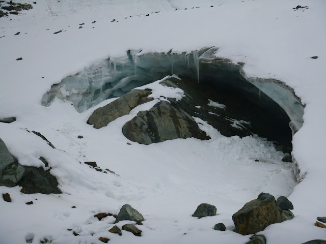
When I got back to camp, Nick and Scott told me they'd found an ice-cave. Of course I had to see it!


The next day the helicopter was delayed due to low visibility. Nick and I killed time by exploring the lower lakes.


Up close it looked like a tropical beach!!


Nick showed off his climbing skills on all the boulders he could find.


Finally the sky cleared enough for pilot Mike King to come pick us up. We were all happy to head home.
Ain't no selfie like a heli-selfie


A few notes:
-Helicopter trips are more affordable than you might think. Scott Pick is the man for planning the best heli-trip with the shortest flight time.
-Rock slides are a real concern in this area. I saw and heard one major rock fall from a distance and would never want to be close to one.
-Scott says there's a good chance I was the first person up that mountain. I guess I'll never know!