Monday, 24 October 2016

D'Arcy to Lillooet via Anderson and Seton Lakes

In September Kat and I paddled from D'Arcy to Lillooet. We travelled across Anderson and Seton Lakes with a nice portage in the middle.

First we drove two cars to Lillooet and parked one at the end of Seton Lake

Kat taking in the view from Lillooet end of Seton Lake. Observing what we were about to paddle.


Then we drove the second car to D'Arcy. There is a nice dock in D'Arcy to launch from.
The docks in D'Arcy.

We enjoyed calm water as we started our journey. We generally stayed near the right (South) side of the lake. A few hours in, whitecapped waves came out of nowhere, so we pulled over and relaxed for 3 hours until they subsided.
The spot we pulled over is really nice, someone had set up a picnic table and there's a clearing for camping.

Once the weather calmed we continued towards Seton Portage, the town between the lakes. We unloaded on a dock and carried our gear up a road and through town. There was a gate on the road, it was easy to walk around the gate.
Kat packing up our gear. The portage wasn't too long. We were probably about 1 hour all together.

We did not see anywhere to set up the tent in Seton Portage, so we launched from a beach on Seton Lake and paddled until we found a nice spot to camp on the lakeside.
View from camp looking towards Seton Portage. I saw two otters here, couldn't get the camera out in time.

Seton Lake has a nice glacial blue color. There are some narrow portions of the lake with large cliffs rising on either side. Railroad tracks follow the North side of the lake, so we stayed closer to that side, in case we would need to pull out and wait out wind. We were lucky for conditions and only encountered some minor headwind.
A journey's end.

This was extremely enjoyable trip! A few notes:
-A few people warned me about wind before setting out on this trip. While this could be an issue (as we saw on Anderson Lake), there are good places to pull out all along both lakes.
-Lake water was pleasantly warm, surprisingly warm for September.
-There are signs of "civilization" all along the trip; power lines, railroad tracks, cabins along the shore.
-We saw one power boat on Anderson Lake and nobody else on the water.
-There are lots of nice places to set up camp along the South side of Anderson Lake, fewer spots along Seton Lake.
-The gate on the road from Anderson Lake to Seton Portage could be tricky to navigate around with a hardshell boat.
-Birkenhead Lake was a nice place to sleep the night before the journey so we could have an early start.
-There is a motel in Seton Portage, staying there would allow one to avoid carrying overnight gear. There is also a restaurant/pub.

Sunday, 23 October 2016

Mount Rohr

With some nice mid-September weather, Kat and I decided to do Mount Rohr. Directions were fairly straightforward following the Matt Gunn scrambles book.

We camped at the far end above Rohr Lake.
We enjoyed a nice sunrise from camp.

The route to the summit was nice and easy to navigate. Mostly on talus. Summit had good views all around especially toward Joffre and Matier across the highway.

Kat's happy to be at the top. Highway 99 below and Joffre and Matier in the distance.

Very nice trip! Rohr Lake on it's own would be a worthy destination.

Mount Currie

In early September I was stoked when Dean proposed we go to Mount Currie summit.

We parked near the Mount Currie trail just passed the Pemberton Speedway. The trail is steep through the trees and pops you out in the alpine.

Dean near the end of the trail, looking back (West) across the valley.

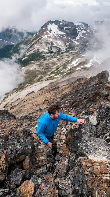
From the point we contoured counter-clockwise around some sub-summits. Then we went up some talus that was covered with a little fresh snow. The summit looked very imposing from below. Once we reached the ridgeline, we found a good path to the summit.
Dean with the last few steps towards summit.

We had some great views on our way down.
Our return route was definitely more efficient.

We were back at the car after about 13 hours roundtrip. A really great day. This was a fun trip. Dean did a great job of preparing the route-plan before we left.

Soo River Paddle

When Peter proposed we take my kayak down Soo River I was shocked. Isn't that class 4/5 whitewater? He explained that we would be heading down the calmer section above the dam.

We dropped off the kayak at the put-in spot about 13kms down the road on the north side of Soo River. Then we parked the car near the dam and walked back up the road to the put-in spot.

Peter at the put-in spot. We wore wetsuits because this water is glacier cold.

The paddling was fun. Beautiful views of the mountains. A few quicker spots, but nothing too bad, One large logjam we had to cross.
At the logjam just before we carried the boat over.

There is a large rock next to the road around km 4. This would probably have been the better pull out location. We kept going until we got to a point we could go no further, We took the boat out and bushwacked about 20m up to the road, then caried the boat back to the car.
I'm sure glad we wore wetsuits!
A great way to spend an afternoon!

Mount Weart via Wedgemont Lake by Night

In August I went up Mount Weart. Because of my scheduling and also fear of sunburns I decided to try this trip at night. It was a great way to try something new and make a standard trip more interesting.

I left the car at 6:30pm and made my way up the Wedgemont Lake trail as the sun was setting

Looking across the valley towards Rainbow Mountain
.
There's a trail around the lake on climber's left. Last bit of light went down just as I passed the lake.
Dusk at Wedgemont Lake


Past the lake I continued beside the glacier and up some slopes. Mostly I moved by moonlight. A few times I turned on the headlamp for routefinding. The photos from Matt Gunn's scrambles book were helpful. I made the summit at 1am. I was back at Wedgemont Lake for sunrise.

First light at Wedgemont Lake


I was back at the car for 9am, drove home and had a snooze.

A few notes:
-I was surprised to find the camping fee box not there. I called BC Parks, they told me that you can no longer pay cash for overnight trips. What a bummer. I explained that I would not be sleeping, they still charged me $15 for the trip, I paid by credit card over the phone. Lucky I had cell signal in the parking lot.
-I was thinking I might like to take a nap in the hut on the way back. But it looked like it was full.
-It was extremely pleasant on the ridgeline with a clear sky and a full moon. The light of the moon reflected off the glaciers prodivded ample light.

Tuesday, 2 August 2016

Sun God Mountain

On Saturday Matt and I bushwacked up to the lake between Seven 0'Clock and Sun God Mountain. On Sunday morning we went up Sun God, then headed home. This trip is well described in the Matt Gunn Scrambles Guide.

We parked near 7km mark of Tenas Creek Forest Service Road. The road is in good shape with large water bars.

Most scenic parking spot I have ever seen.

Then we bushwacked up alongside the creek.
Matty on the bushwack.

We got an awesome sunset from our campsite.
Small lake is just to the right.


The scramble up Sun God was very pleasant.
Matty makes the final move to the summit.


A few notes:
-I have never seen so many mosquitoes in my life. This trip might be better suited to late spring or early fall.
-After the bushwack, the alpine is extremely pleasant.
-Do-able in a daytrip,  I was happy to enjoy a sunset up there.

Thursday, 28 July 2016

Mount Sproatt Hike

I recently moved to Whistler. The view from my patio looks towards Mount Sproatt, so I decided to go up to the top.


View from my patio.

I hiked up different mountain bike trails, using Trailforks as a guide. I made my way up the "Sproatt Alpine Trail". Some friendly guys from WORCA were busy finishing this new trail. After I passed them I bushwacked my way up to the alpine.

The sub-alpine here is very pleasant.
I made my way up to Sproatt summit where there is a summit cairn. From here I could look down to my house.
View from the summit, looking towards Whistler.
Overall a pleasant day. I was out for about 10 hours. Next time I would bring a mountain bike for a quicker trip up and down the bike trails.